This is an investigation of mapping processes and links to my father's work as a geographer. This came out of a need to map a 100 acre bush block in the Waitakere ranges, west of Auckland. I then moved to a flatter more farm like site, where easy public access is available. I made both a 3d map, useful for presentation purposes, and available as a downloadable model, and more traditional 2d maps, spatially linked to data and useful for ongoing management.
3d model Ambury Farm Park, allows measurements and section cutting.
Results
Here are some examples of output.
Sketchfab presentation model 100 acre bush block.
*Sketchfab presentation model Ambury Farm.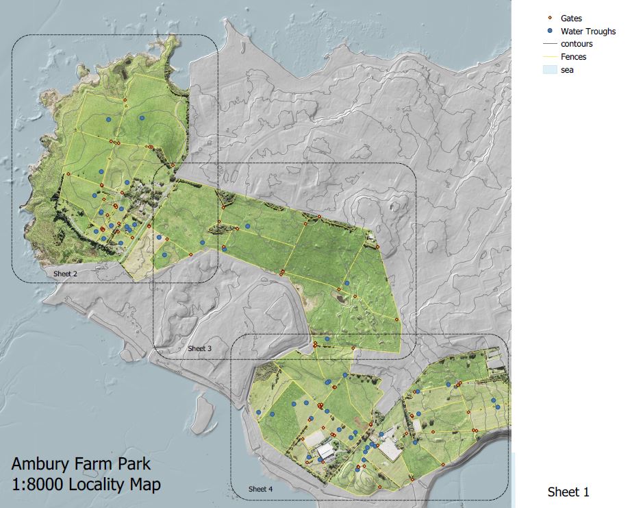 *More traditional 2d map image, whole site
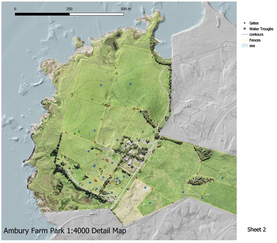 *2d map image, detail.
The maps are available as high resolution pdfs, able to be measured and with gps coordinates, with acrobat reader dc.
How to
The attached pdf gives the method.